P40 RENTAL, P30 RENTAL – P20 RENTALS

P40 elevated.jpg
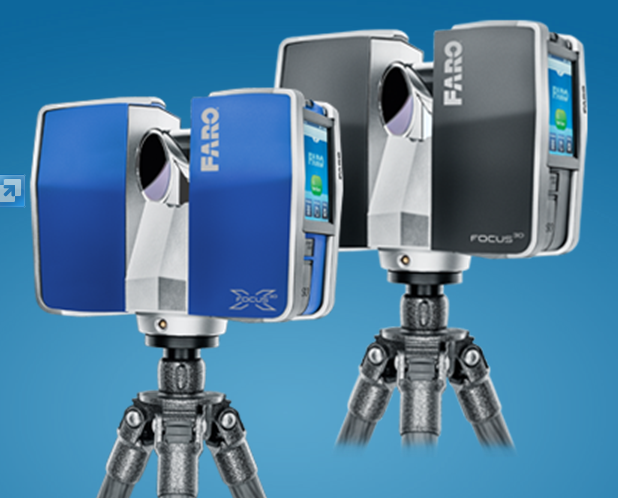
ADSK Solutions has elevated their rental pool. We have P40, P30, P20, C10, 7000 and other scanners available upon request. We aim to always have equipment available for rentals; if we don’t we will help you find what you are looking for.   RESERVE – CAPTURE – RETURN. Targets, target poles, elevated and inverted tri-pods available, and other scanning supplies are also available along with your scanner rentals. ADSK even offers UAV rentals upon request.

ADSK Solutions’s extremely tall, inverted, and easy to use tri-pod made capturing what was at first thought to be impossible, possible. This scan provided the data for the top of an extended construction crane. A simple turn of a power drill initiates the tripod to make it’s climb quickly with ease. No step ladders required. The same tripod was inverted to go where no man really wants to go, inside of a sewer manhole. The secure fasteners kept the scanner safe, and it eliminated those scary safety risks that we all encounter when we need to capture data in out of the ordinary places.

IMG_2935

IMG_4241

Remote Lite app connects directly with Leica P-series scanners

Once in place, the scanner was controlled via an iPhone (an iPad is also capable of running a Leica Scanner). All of the standard commands are still available when utilizing handheld devices.

Manhole inside scan1.JPG

We have to give a shout out to the extreme capabilities of Leica’s P40. It was made for extreme conditions, longer ranges, and the terrible weather no one wants to scan in, rain. The P40 and our inverted tripod will give your firm the advantage to get these “out of the ordinary” scans and set you apart from your competition. Add in the invaluable remote control capabilities using an iPhone or iPad and the options are limitless. These scanning solutions and the training to get you ready to take on that next “out of the ordinary scan” are always available at ADSKsolutions.com. Send us an email to inquire info@ADSKsolutions.com or give us a call at 248.906.ADSK (2375).

ADSK Solutions 3D scanner rental page.


AUTODESK REAL

CAPTURE * COMPUTE * CREATE

Autodesk created a new division called Reality Capture a couple years back. Within that time we have seen Autodesk develop RECAP software for almost all Autodesk design suites, RECAP PHOTO and RECAP PRO for registering point clouds. They have also released Memento and more. Check out the latest in reality capture (computing) and augmenting techology with Autodesk at AUTODESK REAL in SAN FRANSICO. http://www.real2015.com

UAV (DRONE) TRAINING offered by ADSK Solutions

ADSK Solutions, Troy MI offeres UAV aka drone solutions.

ADSK Solutions offers UAV aka Drone traning and solutions.

ADSK Solutions is a techKNOWLEDGEy Partner with a primary focus on reality computing. We are a Autodesk Silver Partner and provide rental solutions for UAVs, 3D laser scanning, static, hand held, mobile, and kinematic; we also offer reality capture solutions for your firm. Recently, we have discovered a need for UAV, or more commonly knowns as Drone, solutions and workflows.

Our UAV training provides the fundamental concepts for UAV flight training, UAV comparisons, FPV (first person point of view), ground station, (waypoints) video processing and a specialization in photo capture to pointcloud (3D model deliverables). Utilizing a GoPro camera ADSK can capture photos, provide flight paths which then allows us to capture topographical surveys. The deliverable is a 3D point cloud on survey control points.

ADSK Solutions photos returned as a point cloud in Autodesk ReCAP.

ADSK photos returned as a point cloud in Autodesk ReCAP.

ADSK Solutions ran a 40 minute flight path and captured our old office building in Troy, MI. Photos were submited to Autodesk ReCap and this 3D point cloud was returned the next day.

Video of this site was also captured when ADSK Solutions teamed with Autodesk and TJ McCue to present Autodesk 3DRV event. One of our guest speakers, Dr Arron Morris from Autodesk, presented the Phanton II and an incredable video that is available here.

ADSK SOLUTIONS first office building 850 Stephenson hwy, Troy, MI

ADSK SOLUTIONS first office building 850 Stephenson hwy, Troy, MI

ADSK Solutions 3D point cloud opened in the free version of Autodesk ReCAP. http://www.autodesk.com/products/recap/free-trial

ADSK SOLUTIONS, UAV point cloud inserted in Autodesk InfraWorks 360.

ADSK SOLUTIONS, UAV point cloud inserted in Autodesk InfraWorks 360.

ADSK Solutions certified professionals, utilizing InfraWorks 360 and Model Builder, created this site  and generated the pointcloud in 20 minutes!

ADSK Solutions creates 3D topographical surface from drone point cloud.

ADSK Solutions creates 3D topographical surface with single click from drone point cloud.

Once inserted into Civil 3D 2015 we were able to create a topographical surface with a single click using the new AutoCAD Civil 3D 2015 Point Cloud Surface Extraction feature availabe on subscription website. Civil 3D points and feature lines could be added to complete topographical survey.

AutoCAD Civil 3D 2015 Point Cloud Surface Extraction

ADSK Solutions training includes all workflows above and covers all the functions of UAV to fly projects successfully. Contact us today and come test fly our drones, run a 3D laser scanner and obtain a better understanding of the functionality and benefits of utilizing Autodesk software. Below is a link to our ADSK Solutions Youtube page for more information about our company and drone projects. 248.906.ADSK – Info@ADSKsolutions.com

3D Laser Scanning on TV – TIME SCANNERS

I am very excited to announce that “Time Scanners” (http://www.pbs.org/program/time-scanners/) – a new TV series featuring Leica scanners and software being used to provide remarkable, new insights into iconic world heritage sites – will be premiering in the USA tonight (PBS @8:00pm Eastern; 7:00 pm Central; 8:00pm Pacific).

“Time Scanners” is, to date, the biggest & best exposure for laser scanning by far to the general public. Lauded as “amazing technology”, the show pairs Leica scanners and software with a renowned structural engineer (Steve Burrows, WSP) to provide viewers with a virtual journey back in time that unlocks some of the world’s oldest engineering mysteries.

The TV series began airing internationally in February and for many months all six episodes (Petra, Pyramids, St. Paul’s Cathedral (London), Coliseum, Machu Pichu, and Jerusalem) had found their way onto YouTube. However, YouTube versions are apparently no longer available, as they were apparently not formally unauthorized. So, if you want to see these shows, you can no longer simply look them up on YouTube. PBS is currently promoting a three-part series (Pyramids, St. Paul’s Cathedral, and Petra), and may possibly opt to air the other three sites in the future.

Steve Burrows and Malcolm Williamson of Univ of Arkansas Center for Advanced Spatial Technologies (CAST) gave a thrilling, standing-room-only presentation on Time Scanners at HxGN LIVE (picture below is Steve Burrows and myself after his presentation). Almost all of these sites had been scanned in the past and all had been studied by learned specialists for many, many years. So, what was the key to unlocking amazing, new secrets for this TV series? The key was putting rich, accurate, 3D scan data in front of the right person – in this case, Steve Burrows – who viewed the data with the eyes and experience of a world-class structural and building engineer. Another key was manipulating it (done by CAST staff) and viewing it in just the right way for him. The importance of those general ideas – providing the right deliverable to the right person – carry well beyond this TV series.
timescanners
If you’re into scanning and want your friends & family to appreciate the technology you use, have them watch this if they can. Also, anyone into construction or architecture will love these shows, so pass the word.

For additional information about the teams behind this series and each site, see this link for Atlantic Productions (UK), which produced the TV series: http://www.timescanners.com/us/

Enjoy!

Best regards
Geoff

CAPTURING & AUGMENTING TECHNOLOGY PRESENTATION – NextWave Media Labs ………. JULY 16th – TROY, MI

ADSK Solutions is partnering with Autodesk to host a COMPLAMENTARY EVENT in TROY, MI. to showcase new technology around Reality Computing. 3D Laser scanning, target FREE registration, UAV’s, Flying cameras for 3D reconstructions, Autodesk ReCAP, Autodesk InfraWorks 360 preview and factory scanning workflows.

This event will showcase Robert Shear, Senior Director, Reality Solutions, Autodesk. Robert Shear leads the new Reality Capture division at Autodesk. You do not want to miss this presentation. He will speak about current technology and where it is going in the future. Reserve your seat TODAY!

JULY 16TH 1:30 PM - NEXTWAVE MEDIA LAB, TROY MI

JULY 16TH 1:30 PM – NEXTWAVE MEDIA LAB, TROY MI

3D SENSOR for ipad ……..Mobile Scanning

Structure sensor

This 3D Sensor will revolutionize Reality Capture and Augmenting for Design.

Structure sensor is another path for the future of mobile scanning.  Simply point and capture with your iPAD. Whatever you AIM at becomes digital in your computer. Capture every dimension of a room in seconds and share it on your phone for verification. Architects, Plant layout, Construction, Forensics, Gamers; etc. Combine this with 3D printing capabilities and I could brainstorm all day. Checkout the video below to see how virtual world will be used to play games in the near future.

$329 and imagination is all you need. For $329 I will buy one to finish my basement, deck, or landscaping.

xboxkinect

You probably own a device like this already. Did you know the technology came from the XBOX Kinect?

The xbox tracks your location utilizing sensors.

ADSK Solutions does not profit from any of the Kickstarter projects. We are showing/bragging about these projects because we are excited to use them as well. As a techKNOWLEDGEy partner we find the technology; learn the workflows and bring them to life for real-world applications. Our time, and experience will build knowledge, and prepare us to share with you when the product is actually ready for mainstream. Below is the link to get in on the ground floor like we did. You have less than 24 hours. We will continue to provide project updates after we receive out sensor. Structure Sensor Kickstarter

ADSK black logo 800x600

New FARO Laser Scanner Focus3D X 330 rumored to be at 60k

FARO Ships Laser Scanner Focus3D X 330 (It appears to be the same scanner model as the Faro Focus but shown in Blue instead of Black.)new Faro image                                                           LAKE MARY, FL, Oct 8, 2013 – FARO Technologies, Inc., the world’s most trusted source for 3D measurement, imaging and realization technology, announced today it has released the new FARO Laser Scanner Focus3D X 330.
Building on the success of the Focus 3D, the new Focus3D X 330 surpasses previous models in functionality and performance. With a range almost three times greater than previous models, the Focus3D X 330 can scan objects up to 330 meters away and in direct sunlight. With its integrated GPS receiver, the laser scanner is able to correlate individual scans in post-processing making it ideal for surveying based applications.

In addition, the Focus3D X 330 scan quality has been increased and noise has been reduced, providing precise three dimensional models in a photo-realistic style. These advances in performance did not come at the expense of safety as the Focus3D X 330 includes a class 1 “eye safe” laser.

“Its minimal weight, small size, touch-screen, SD-card and a battery life of 4.5 hours make the Focus3D X 330 unbeatable and easy-to-use,” said Dr. Bernd Becker, chief technology strategist for the new Focus3D X 330. “No other provider can offer such a technical achievement.”

With its increased range and scan quality, the Focus3D X 330 considerably reduces the effort involved in measuring and post-processing. The 3D scan data can easily be imported into all commonly used software solutions for accident reconstruction, architecture, civil engineering, construction, forensics, industrial manufacturing and land surveying. Distance dimensions, area and volume calculations, analysis and inspection tasks and documentation can thus be carried out quickly, precisely and reliably.

http://www.tenlinks.com/news/PR/faro/100813_focus3d.htm

Kinematic Mobile 3D Laser Scanning

Attach any static scanner that provides the profile option to the top of the trolly, golf cart, all-terrian vehical or use custom mount and actually walk with the system. The presentation below was provided from an event that ADSK Solutions provided at Comerica park (Tiger Stadium) in downtown Detroit. The data is captured, processed, and shown in Autodesk ReCap and Autodesk Infraworks 2014.

The PROSCAN system captures data INSIDE and OUTSIDE. The system is currently available for purchase and ADSK Solutions offer proof of concept projects. We are located in Troy, Michigan and looking  forward to your feedback. chadstuder@ADSKsolutions.com

Autodesk ReCap Pro available for Download

Video

Autodesk ReCap Pro provides the ability to register 3D laser scans together.
Watch Autodesk ReCAP Pro presentation in 3 minutes or less.

3D laser scanning provides the ability to capture existing as-built data. Millions of photo realistic and highly accurate 3D measurements can be acquired in seconds and collectively digitize any environment as a cloud of individual points. The 3D laser scanner is moved throughout the facility to capture data. Like placing pieces together to complete a puzzle. 3D laser scan locations must be tied together.

Autodesk ReCap Pro provides a seamless workflow to complete this with or WITHOUT utilizing targets. Simply match two points in plan-view with overlapping scandata and Autodesk ReCap Pro will run an algorithm to register both scan locations together. Once the algorithm is complete, accuracy of overlapping data is reported. Autodesk ReCap Pro can also combine scan locations from perspective views. This is often known as cloud to cloud registration. Select three points in each scan location and scan data is registered as one. Autodesk ReCap Pro has enhanced this workflow by providing images. Matching three points’ from side by side overlapping images has simplified the registration process. Once three points are matched in side by side photos a 3D registered point cloud is developed and a 3D virtual site is created replicating complete accurate as-built data of existing conditions. This 3D registered point cloud can be viewed in Autodesk ReCap. Measurements can be taken from anywhere within the virtual facility. Data can be placed on unique regions and turned off as required for renovations. Sections can be developed to compare 3D virtual site to existing 2D CAD drawings for verification of existing as-built data.

Autodesk REALITY CAPTURE TEAM has been busy. This team has only been together for a little more than a year and have already released Autodesk ReCap, ReCap Photo and ReCap PRO. Autodesk is dedicated to providing the best software in the world for utilizing Point clouds. I encourage everyone to get familiar with point clouds. Soon PC will stand for Point Clouds not personal computer.
Autodesk ReCap Pro Download

Cyclone 8.03 update and firmware release

Cyclone update 8.03 has been released to solve a couple of issues. Most noticable it provides the ability to import P20 data without requiring a network or wi-fi connection.
8.02 upgrade to .03

Leica ScanStation P20 Firmware V1.21 05/29/2013 is available for the P20. Be sure to to install this on the P20 or blue coloring can appear during outside photos.
P20 bad image